O'Neill Trail

The O'Neill Trail is a multi-use trail that connects Mount Barker and Porongurup. It was officially opened in September 2023.
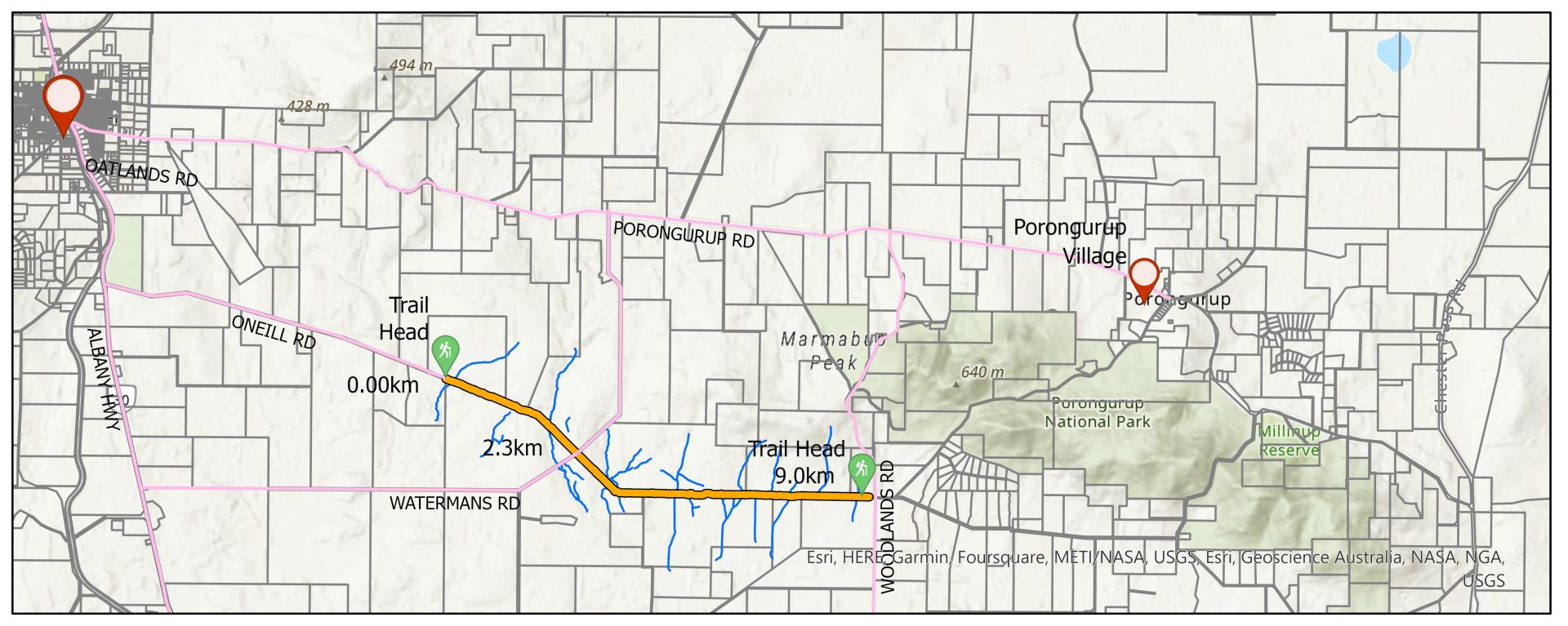
The trail links the end of O’Neill Road and Woodlands Road in Porongurup and caters to pedestrians, cyclists including e-bikes riders, and horse-riders. The route is 18-kilometres return.
Parking is provided at both trailheads, including for vehicles towing horse floats, with users able to travel the trail in either direction.
The trail was named in honour of the O’Neill family, who were pioneers in the Plantagenet area, and whose history has been incorporated into trailhead signage.
The trail is part of the Great Southern Regional Trails Masterplan 2020-2029, which aims to establish the Great Southern as a world-class trails destination.
The O’Neill Trail was jointly funded by the Shire ($21,358 contribution) and the Australian Government’s Local Roads and Community Infrastructure Program ($35,100 contribution towards the development of Stage 1A).
Federal Member for O’Connor Rick Wilson said the Local Roads and Community Infrastructure Program had been designed to directly fund projects that local governments such as Plantagenet considered to be high priorities.
A map of the trail is available below.
O'Neill Trail quick stats:
- Look for the signpost on Albany Highway at the intersection of O’Neill Road.
- Follow O’Neill Road for 7.2kms and you will see the trailhead.
- Class 2 walking trail, allow six hours return.
- Class 3 equestrian trail, allow six hours return.
- Very easy cycling trail, allow 3.5 hours return.
- Take all rubbish with you – leave no trace.
- Horse-riders are reminded that feed, fodder and manure may introduce weeds to the area, which would compete with native flora – please ride responsibly.